Infos :
Pictures :
Site Links :
Help of Travel :
|
|
Namibia : Transportation
Prepare your travel to Namibia
I. Car hire Namibia
II. The network infrastructure in Namibia
» Infrastructure Land : 5450km of paved roads and 37 000km of pistes.
» Maritime infrastructure : The main ports are Walvis Bay and Luderitz.
» The rail network : 2382km.
» Airstrips : over 300.
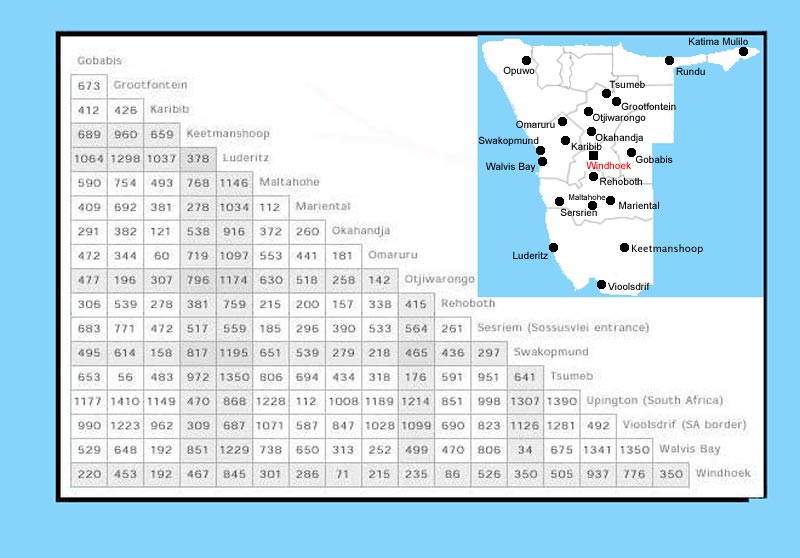
Tables of distances:

Distance between cities dde Namibia
III. Quality of roads in Namibia
- road conditions Namibia
- roads photos (slideshow)
IV. Major airports in Namibia
National and international airports:
» Hosea Kutako International Airport - 45km east of Windhoek
» Eros Airport - Windhoek
» Katima Mulilo - 20km west of Katima Mulilo
» Rundu-3km west of Rundu
» Ondangwa
» Walvis Bay - 20km east of Walvis Bay
» Lüderitz - 10 km east of Lüderitz
» Keetmanshoop - 3km north of Keetmanshoop
Namibia lists more than 300 airstrips. It is not advisable to use the tracks unregulated.
For more information about airports, you can visit the following sites:
http://www.airports.com.na
http://www.airnamibia.com.na
V. Map and information for rail network
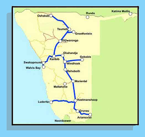
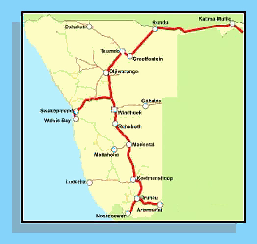
 Railway Networks in Namibia
The Namibian railway network is safe but limited and slow.
Mainly used for freight and local populations.
Site Namibian railway network: http://www.transnamib.com.na/Starline.htm
VI. Map Transit
 Bus networks in Namibia
Bus company across Southern Africa in Namibia is notament:
http://www.intercape.co.za/
Source : 2008
|
|
|
|
|
|
|
|


